 New Delhi:
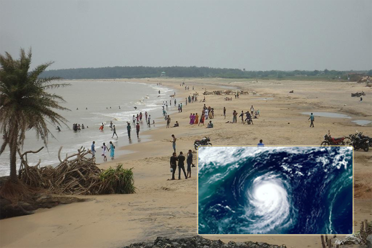
 A deep depression over the Bay of Bengal has intensified into cyclonic storm 'Yaas' and is likely to cross the Odisha-West Bengal coasts on May 26 after turning into a very severe cyclonic storm, the MeT Department said on Monday.
"The Deep Depression over East-central Bay of Bengal remained practically stationary during past 6 hours, intensified into Cyclonic Storm ‘Yaas’ and lay centred at 0530 hrs IST of Monday over East-central Bay of Bengal near latitude 16.3°N and longitude 89.7°E, about 600 km north-northwest of Port Blair (Andaman Islands), 540 km south-southeast of Paradip (Odisha), 650 km south-southeast of Balasore (Odisha) and 630 km south southeast of Digha (West Bengal)," the IMD said in a bulletin at 8:30 AM.
They added, "It is very likely to move slowly north-northwestwards, intensify further into a Severe Cyclonic Storm during next 24 hours and into a Very Severe Cyclonic Storm during subsequent 24 hours."
Neighbourhoods in the Behala-Thakurpukur belt, which was waterlogged for days and was without power for more than a week following Amphan — have started taking pre-emptive measures like stocking rechargeable emergency lights, candles, mineral water drums and food two days before Yaas is slated to hit the city.
60 teams of Odisha Disaster Rapid Action Force being deployed in the state with equipment for rescue, relief & recovery, in view of cyclone Yaas. "Fishermen have been asked not to venture into the sea. We'll try to ensure there is no casualty," additional SP, Paradeep.
As per the weather department, Cyclone Yaas would continue to move north-northwestwards, intensify further and reach Northwest Bay of Bengal near north Odisha and West Bengal coasts by May 26 early morning.
Subsequently, it is very likely to cross north Odisha-West Bengal coasts between Paradip and Sagar islands around noon of May 26 as a Very Severe Cyclonic Storm.
Union home minister Amit Shah to hold a meeting via video conference today with the chief ministers of Odisha Andhra Pradesh, West Bengal and the lieutenant governor of Andaman and Nicobar Islands to review preparations in view of cyclone Yaas.
Deep depression over east-central Bay of Bengal intensified into Cyclonic Storm ‘Yaas’ and about 600km of Port Blair. To intensify into a Severe Cyclonic Storm during next 24 hours and into a Very Severe Cyclonic Storm during subsequent 24 hours.
The India Meteorological Department predicted light to moderate rainfall at most places with heavy to very heavy rainfall over Medinipur, South & North 24 Parganas, Howrah and Hooghly districts on May 25. It also predicted extremely heavy rainfall at isolated places over Jhargram, Medinipur, North & South 24 Parganas, Howrah, Hooghly, Kolkata and heavy to very heavy rainfall at a few places over Nadia, Bardhaman, Bankura, Purulia, Bhirbhum and heavy falls at isolated places over Murshidabad, Malda and Dakshin Dinajpur Districts on May 26.
On May 27, heavy to very heavy rain is expected at isolated places in Malda and Darjeeling, Dinajpur, Kalimpong, Jalpaiguri, Sikkim and heavy rain at a few places over Bankura, Purulia, Bardhaman, Bhirbhum and Murshidabad.
The IMD predicted light to moderate rainfall at many places with heavy falls at isolated places over South Coastal Odisha on May 24, heavy to very heavy rainfall in the north coastal districts on May 25, heavy to very heavy rains at a few places with extremely heavy falls in Balasore, Bhadrak, Kendrapara, Mayurbhanj and heavy to very heavy falls at a few places in Jagatsinghpur, Cuttack, Jajpur, Keonjhar on May 26.
On May 27, heavy to very heavy rainfall is likely at isolated places in north interior Odisha. Isolated heavy to very heavy rainfall is likely over the south coastal districts of Odisha on May 25 and May 26.
The IMD also predicted light to moderate rainfall at many places with heavy falls at isolated places on May 24 and heavy to very heavy falls at isolated places on May 25 and May 26.
The IMD said that light to moderate rainfall will occur at most places with heavy to very heavy rainfall at isolated places over Jharkhand and extremely heavy rainfall over southeast Jharkhand on May 26 and May 27.
As per IMD, light to moderate rainfall will be seen at most places with heavy to very heavy rainfall at isolated places over Bihar on May 27.
The IMD stated that light to moderate rainfall will take place at most places with heavy to very heavy rainfall at isolated places over Assam, Meghalaya on May 26 and May 27.
Southwest monsoon, which was earlier expected to arrive in Karnataka in the first week of June, is now likely to set in at least four days early. According to the Karnataka State Natural Disaster Monitoring Centre (KSNDMC), the onset of monsoon was projected for May 31 in Kerala and for June 3 or 4 in Karnataka. The new projections show it could hit Karnataka as early as May 31 or June 1 because of cyclone Yaas, it added.
The Odisha government has asked the collectors in coastal districts, especially Balasore, Bhadrak, Jagatsinghpur and Kendrapada to ensure smooth treatment of Covid patients and uninterrupted power supply to Covid hospitals as the imminent cyclone is likely to cause maximum damage in the four regions. The government said adequate high-powered diesel generator sets would be positioned in the Covid-19 hospitals.
Three days before Yaas is slated to reach Kolkata, staffers from the civic authority and power utility hit the ground on Sunday morning, visiting the most vulnerable localities along the city’s southern belts where power lines are overhead. Apart from trimming weak branches, the civic staff and cops did the rounds of dilapidated buildings to convince residents to move out till after the storm. KMC drainage department officials inspected the pumping stations to make sure the arrangements were in order.
For the past two days, environmentalists and ecologists have alerted the civic body to put reinforcements against vulnerable trees to protect them from the possible onslaught of the cyclonic storm which can pass through the city.
Yaas is likely to thunder into the Bengal-Odisha coast between Sagar Island and Paradeep on May 26 evening with the Bengal coast more likely to take the hit after it crosses north Odisha as a very severe cyclonic storm with a wind speed of 155km/hr-165km/hr.
The Odisha government on May 24 relaxed lockdown restrictions in 10 districts for two days in view of the impending very severe cyclonic storm Yaas.
“The deep depression, which remained practically stationary over east-central Bay of Bengal during the past six hours, intensified into cyclonic storm Yaas at 5.30 a.m.”, said H. R. Biswas, Director of Bhubaneswar Meteorological Centre, on Monday.
It lay centred about 600 km north-northwest of Port Blair (Andaman Islands), 540 km south-southeast of Paradip (Odisha), 650 km south-southeast of Balasore (Odisha) and 630 km south-southeast of Digha (West Bengal), according to an India Meteorological Department bulletin.
It is very likely to move slowly north-northwestwards, intensify further into a severe cyclonic storm during the next 24 hours and into a very severe cyclonic storm in the subsequent 24 hours, bulletin informs.
The IMD predicted that it would continue to move north-northwestwards, intensify further and reach northwest Bay of Bengal near north Odisha and West Bengal coasts by May 26 early morning. It is very likely to cross north Odisha-West Bengal coast between Paradip and Sagar Islands around May 26 noon as a very severe cyclonic storm.
With a view to allow people more time to obtain essential items from markets during lockdown before the impending cyclone reaches the coast of Odisha, the government has allowed shops to operate between 7 a.m. and 1 p.m. in 10 districts, said Chief Secretary Suresh Chandra Mohapatra in a notification.
People can procure milk products and food items in districts such as Balasore, Bhadrak, Puri, Cuttack, Khordha, Jagatsinghpur, Kendrapara, Mayurbhanj, Keonjhar and Jajpur.
Eastern Railway suspends 25 trains between May 24 and 29 in view of cyclone Yaas, reports ANI
Thunderstorm with lightning and gusty wind 30-40 kmph and light to moderate rainfall likely to occur in parts of Kolkata and Howrah of West Bengal during next 2-3 hours (issued at 01:10 hours), says India meteorological department (ANI)
Cyclone 'Yaas' over the Bay of Bengal is likely to intensify into a very severe cyclone and will cross the coast between Paradeep and Sagar Island on Wednesday, said India Meteorological Department (IMD). The cyclone with possible wind speed gusting to 185 km per hour may have large-scale damaging impact and would have maximum impact on four coastal districts of Jagatsinghpur, Kendrapada, Bhadrak and Balasore.
In view of the warnings of Cyclone Yaas, which is likely to make landfall on May 26, Odisha Special Relief Commissioner Pradeep K Jena reviewed the preparedness in coastal districts of the state on Sunday and said adequate arrangements have been put in place.
Amidst the ongoing major operations in wake of Covid-19 and Cyclone Tauktae, the armed forces have now also deployed warships, aircraft, helicopters, flood relief teams and engineer task forces for any contingency on the eastern seaboard due to the approaching Cyclone Yaas.
 New Delhi: A deep depression over the Bay of Bengal has intensified into cyclonic storm 'Yaas' and is likely to cross the Odisha-West Bengal coasts on May 26 after turning into a very severe cyclonic storm, the MeT Department said on Monday.